Analysis of sets of factors affecting the variable flow of the Amu Darya River to create a seasonal prognostic model
G. Shadurdyyev
Kazakh-German University, Almaty, Kazakhstan
E-mail: govsutsadurdyev@gmail.com
https://doi.org/10.29258/DKUCRSWP/2022/53-72.eng
December 21, 2022
Abstract
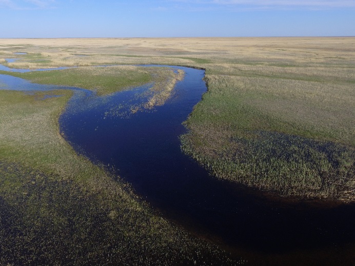
The Amu Darya River is a transboundary river whose flow of the river in high-water years reaches up to 108 km3 and in low-water years up to 47 km3 and these are huge fluctuations in the water flow of the river for Tajikistan, Kyrgyzstan, Uzbekistan, Turkmenistan, and Afghanistan, that share water among themselves. The point to consider is that the downstream countries Turkmenistan and Uzbekistan (and possibly Afghanistan in the future) use a lot of water for irrigation, and therefore these countries are the ones most in need of an accurate forecast of the volume of water for the upcoming season. An accurate forecast of the volume of water on the seasonal scale is necessary for better planning of the structure of crops, and subsequently water use in the irrigation of crops. An acceptable solution to this challenge is the construction of an empirical time series model that will be used to predict the seasonal flows of the Amu Darya River to improve the planning and management of water resources in downstream countries.
This article considers three important discharge time series in the larger Amu Darya Basin. These include the Kerki Gauge on the Amu Darya, Darband Gauge on Vaksh River and Khorog Gauge on Gunt River. Long-term time series from these stations are available for the study of the development and implementation of time-series based models for the prediction of discharge in the basin. At this stage, we attempt to demonstrate a proof-of-concept which can in a second step convince stakeholders to share such type of discharge data operationally for more effective water allocation between sectors and countries. All our work was carried out with the quantitative tools R/RStudio and QGIS. It can serve as a stepping stone for more complex forecasting models in the future.
Available in English
Download the Paper
To cite the working paper: Shadurdyyev G. (2022). Analysis of sets of factors affecting the variable flow of the Amu Darya River to create a seasonal prognostic model. DKUCRS Working Papers Series. Available at: https://doi.org/10.29258/DKUCRSWP/2022/53-72.eng
Rerefences
About Turkmenistan. (n.d.). Retrieved July 2, 2022, from http://www.dntours.com/index. php?option=com_content&view=category&id=39&Itemid=69&lang=en
Agreement between the Republic of Kazakhstan, the Kyrgyz Republic, the Republic of Tajikistan, Turkmenistan and the Republic of Uzbekistan on Cooperation in the Field of Joint Management on Utilization and Protection of Water Resources from Interstate Sources. (n.d.). Retrieved July 2, 2022, from http://www.icwc-aral.uz/statute1.htm
Agreement between Uzbekistan and Turkmenistan on cooperation on water management questions. (n.d.). Retrieved July 2, 2022, from https://cis-legislation.com/document.fwx?rgn=25361
Annina Sorg1,2*, Tobias Bolch3,4, Markus Stoffel1,2, Olga Solomina5 and Martin Beniston1. (2012). Climate change impacts on glaciers and runoff in Tien Shan (Central Asia). NATURE CLIMATE CHANGE. https://www.nature.com/articles/nclimate1592
Apel, H., Abdykerimova, Z., Agalhanova, M., Baimaganbetov, A., Gavrilenko, N., Gerlitz, L., Kalashnikova, O., Unger-Shayesteh, K., Vorogushyn, S., & Gafurov, A. (2018). Statistical forecast of seasonal discharge in Central Asia using observational records: Development of a generic linear modelling tool for operational water resource management. Hydrology and Earth System Sciences, 22(4), 2225–2254. https://doi.org/10.5194/hess-22-2225-2018
Apel, H., Abdykerimova, Z., Agalhanova, M., Baimaganbetov, A., Gerlitz, L., Kalashnikova, O., Unger- Shayesteh, K., & Vorogushyn, S. (2017). Statistical forecast of seasonal discharge in Central Asia for water resources management: Development of a generic linear modelling tool for operational use. 31.
Beck, H. E., Wood, E. F., McVicar, T. R., Zambrano-Bigiarini, M., Alvarez-Garreton, C., Baez-Villanueva, O. M., Sheffield, J., & Karger, D. N. (2020). Bias Correction of Global High-Resolution Precipitation Climatologies Using Streamflow Observations from 9372 Catchments. Journal of Climate, 33(4), 1299–1315. https://doi.org/10.1175/JCLI-D-19-0332.1
Brun, P., Zimmermann, N. E., Hari, C., Pellissier, L., & Karger, D. N. (2022). Global climate-related predictors at kilometre resolution for the past and future. Earth System Science Data Discussions, 1–44. https://doi.org/10.5194/essd-2022-212
Buchhorn, M., Smets, B., Bertels, L., De Roo, B., Lesiv, M., Tsendbazar, N.-E., Herold, M., & Fritz, S. (2020). Copernicus Global Land Service: Land Cover 100m: collection 3: epoch 2019: Globe. https://doi.org/10.5281/zenodo.3939050
Dixon, S. G., & Wilby, R. L. (2019). A seasonal forecasting procedure for reservoir inflows in Central Asia. River Research and Applications, rra.3506. https://doi.org/10.1002/rra.3506
Farr, T. G., Rosen, P. A., Caro, E., Crippen, R., Duren, R., Hensley, S., Kobrick, M., Paller, M., Rodriguez, E., Roth, L., Seal, D., Shaffer, S., Shimada, J., Umland, J., Werner, M., Oskin, M., Burbank, D., & Alsdorf, D. (2007). The Shuttle Radar Topography Mission. Reviews of Geophysics, 45(2), RG2004. https://doi.org/10.1029/2005RG000183
Gerlitz, L. (2020). Climate informed seasonal forecast of water availability in Central Asia_ State-of-the-art and decision making context. Water Security, 12.
ISIMIP Repository. (n.d.). Retrieved April 28, 2022, from https://data.isimip.org/10.48364/data. isimip.org
Kamil, I. (2021). Afghanistan, the Amu Darya Basin and Regional Treaties. Chinese Journal of Environmental Law, 5(1), 37–62. https://doi.org/10.1163/24686042-12340063
Karger, D. N. (n.d.). High-resolution monthly precipitation and temperature time series from 2006 to 2100. 10.
Karger, D. N., Conrad, O., Böhner, J., Kawohl, T., Kreft, H., Soria-Auza, R. W., Zimmermann, N. E., Linder, H. P., & Kessler, M. (2017). Climatologies at high resolution for the earth’s land surface areas. Scientific Data, 4(1), Article 1. https://doi.org/10.1038/sdata.2017.122
Karger, D. N., Lange, S., Hari, C., Reyer, C. P. O., & Zimmermann, N. E. (2021). CHELSA-W5E5 v1.0: W5E5 v1.0 downscaled with CHELSA v2.0. https://doi.org/10.48364/ISIMIP.836809
Karger, D. N., Schmatz, D. R., Dettling, G., & Zimmermann, N. E. (2020). High-resolution monthly precipitation and temperature time series from 2006 to 2100. Scientific Data, 7(1), Article 1. https://doi.org/10.1038/s41597-020-00587-y
Karger, D. N., Wilson, A. M., Mahony, C., Zimmermann, N. E., & Jetz, W. (2021). Global daily 1 km land surface precipitation based on cloud cover-informed downscaling. Scientific Data, 8(1), 307. https://doi.org/10.1038/s41597-021-01084-6
Karger, Dirk Nikolaus, Dabaghchian, Babek, Lange, Stefan, Thuiller, Wilfried, Zimmermann, Niklaus E., & Graham, Catherine H. (2020). High resolution climate data for Europe (1.0, p. 10 KB, KB) [NetCDF,PDF]. EnviDat. https://doi.org/10.16904/ENVIDAT.150
Kaya, E., Agca, M., Adiguzel, F., & Cetin, M. (2019). Spatial data analysis with R programming for environment. Human and Ecological Risk Assessment: An International Journal, 25(6), 1521–1530. https://doi.org/10.1080/10807039.2018.1470896
Kostianoy, A. G., Lebedev, S. A., & Solovyov, D. M. (2013). Satellite Monitoring of the Caspian Sea, Kara-Bogaz-Gol Bay, Sarykamysh and Altyn Asyr Lakes, and Amu Darya River. In I. S. Zonn & A. G. Kostianoy (Eds.), The Turkmen Lake Altyn Asyr and Water Resources in Turkmenistan (Vol. 28, pp. 197–231). Springer Berlin Heidelberg. https://doi.org/10.1007/698_2013_237
Muradov R. (2013, November 22). Along the banks of the Jayhoon: The innkeepers and settlements on the ancient trade route. [Vdol’ beregov Dzhejhuna: Postoyalye dvory i poseleniya na drevnem torgovom puti.] https://turkmenportal.com/blog/2182
Reynolds, R. W., Rayner, N. A., Smith, T. M., Stokes, D. C., & Wang, W. (2002). An Improved In Situ and Satellite SST Analysis for Climate. Journal of Climate, 15(13), 1609–1625. https://doi. org/10.1175/1520-0442(2002)015<1609:AIISAS>2.0.CO;2
Reynolds, R. W., & Smith, T. M. (1994). Improved Global Sea Surface Temperature Analyses Using Optimum Interpolation. Journal of Climate, 7(6), 929–948. https://doi.org/10.1175/1520- 0442(1994)007<0929:IGSSTA>2.0.CO;2
T. Siegfried & B. Marti. (2022, March 4). Modeling of Hydrological Systems in Semi-Arid Central Asia. https://hydrosolutions.github.io/caham_book/
White, C. J., Tanton, T. W., & Rycroft, D. W. (2014). The Impact of Climate Change on the Water Resources of the Amu Darya Basin in Central Asia. Water Resources Management, 28(15), 5267– 5281. https://doi.org/10.1007/s11269-014-0716-x
Amu Darya River, discharge prediction, hydrological characterization, QGIS, R/RStudio